Wikimaps User Group/Activity reports
| Wikimaps | Members | Reports | Projects |
| This is a list of activities, projects, and milestones that members of the Wikimaps User Group have implemented listed in reverse chronological order. |
2024
edit2023
editContacts 2023
editGeography & Wikimedia related projects
editYou are welcome to add your Wikimedia & geography -related project below at any time.
![]()
At Wikimania, Wikimaps UG organized Wikimapathon, a series of lectures and mapping activities.


2022
editContacts 2022
editGeography & Wikimedia related projects
editYou are welcome to add your Wikimedia & geography -related project below at any time.
- Wikimaps @ Wikimedia hackathon 2022
- "Live Wikidata Editing" have had several sessions focused on Wikidata/SPARQL/OSM maps.
- WikiConference North America 2022 (WCNA) partnered with OpenStreetMap US's 2nd annual Mapping USA
- Open Boro Map
2021
editGovernance
editThe Wikimaps User Group is proposing to remain organized with the minimum governance required. Two contact persons are selected for the next year before the end of each year in an election on these pages. Reporting of projects takes place collaboratively on this page. If a sturdier governance model was needed to run an event, for example, the group could start a process to establish a different governance model at any time of the term. Discussion in the Wikimaps Telegram group remains the main activity for the time being. See the Revitalization page and discussion and the poll & question in the Wikimaps Telegram group for further information.
Contacts 2021
editGeography & Wikimedia related projects
editYou are welcome to add your Wikimedia & geography -related project below at any time.
- Saami place names to Wikidata as lexicographical data will be a collaboration between AvoinGLAM and Wikimedia Norway.
- Wikidocumentaries is using Edward Betts' Wikidata OSM Matcher API to retrieve geographic shapes for the topic pages
- "Live Wikidata Editing" have had several sessions focused on Wikidata/SPARQL/OSM maps.
- Wikidata:WikiProject Early Modern England and Wales is a partnership with the collaborative Viae Regiae project, focused on understanding and mapping the developing transport networks of England and Wales in the period before mass industrialisation.
- Hack4OpenGLAM featured map-related proposals, which can be reviewed via the Dashboard.
2020
editSeveral Wikimedia & geography projects were carried out throughout the year despite the pandemic. You are welcome to add your Wikimedia & geography -related project below at any time.
Contacts 2020
editTelegram
editThe Wikimaps Telegram group was set up. It proved to reach more wikimedians than any previous activity, and has since then become the main form of activity. It provides a platform for an exchange of ideas in developing members' projects that have a spatial component.
Related projects
editCOVID-19
edit
Users responded to the COVID-19 pandemic with a flurry of timely, well-researched choropleth maps.
OpenStreetMap
edit- Federated query visualizations based on OpenStreetMap and Wikidata
-
 Logos of the most common chain stores
 -
 The most common public transportation route colors
 -
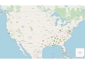 Monuments and namesakes of notable Confederates, slave traders, segregationists, etc.


Wikimedians within the OpenStreetMap project developed a large collection of example SPARQL queries for Sophox, a fork of the Wikimedia Query Service that federates with OpenStreetMap data. A poster of the most common flags mapped in OpenStreetMap was presented at the international State of the Map conference, coinciding with efforts to identify and tag flagpoles with Wikidata QIDs across the Philippines and southeastern United States. In response to the Black Lives Matter protests, mappers systematically tagged monuments and namesakes of people relevant to discussions about race in the United States. The OpenStreetMap U.S. Connect 2020 conference included an introduction to OpenStreetMap's use of Wikidata, the Wikidata data model, and Sophox.
Hack4OpenGLAM
editArun Ganesh ran a workshop on Open Geo Commons at the Hack4OpenGLAM cultural hackathon at the Creative Commons Global Summit, also as part of the celebrations for the 8th birthday of Wikidata arranged by the Indian Wikimedia community.
"Live Wikidata Editing" workshop was part of the hackathon's program as well, featuring geographic WDQS maps, WDQS timelines, and SPARQL.
Open Historical Map
editOpen Historical Map added a rich detail view that embeds Wikipedia and Wikimedia Commons content related to the selected historical feature (example).
Further projects & processes
editPlease add a note about your projects here
A group of Wikimedians are thinking about how georeferencing data from the Wikimaps Warper, external georeferencing tools, and future local tools can better be stored and served in Structured data on Commons.
Wikimedia Finland added protected buildings from Helsinki and Tampere to Wikidata for the Wiki Loves Monuments competition. The Wikidata items are used to categorize uploaded images from Finna on Wikimedia Commons.
Wikidocumentaries maps component was remodeled collaboratively. Wikidocumentaries also developed a banner to display during the Wiki Loves Monuments competition for uploading image entries.
COLOR
editThe Wikimaps User Group voted to sign the Community open letter on renaming (COLOR) agreeing that the Movement Brand process was deeply flawed.
2019
editWikidataCon 2019
edit
Edward Betts and Eugene Alvin Villar reprised their workshop during State of the Map 2019 (see section below) by giving a 25-minute presentation at WikidataCon 2019. The presentation introduced OpenStreetMap and its data model to Wikimedians, explained how Wikidata and OSM can link to each other, how OSM is being used in Wikimedia projects, how Wikidata is being used in OSM, and provided a demonstration of Edward's tool to add Wikidata tags to OSM objects.
More info:
- Photos by Hijjawi
-

-

-

-


State of the Map 2019
edit

Edward Betts and Eugene Alvin Villar conducted a 55-minute workshop during State of the Map 2019, the annual international conference for the OpenStreetMap community, to introduce Wikidata to an audience consisting mostly of OpenStreetMap contributors. During the workshop, Eugene talked about a bit of history of Wikidata and why it was created and explained the benefits of linking Wikidata and OSM with each other. Edward then introduced and demonstrated his online tool that allows OSM user to add Wikidata tags to OSM objects. Edward also touched a bit on the problems of and limitations on linking OSM with Wikidata (including the fact that there can never be a one-to-one correspondence between OSM objects and Wikidata items). More info: Eugene's OSM diary entry.
Wikimania 2019
edit
- Bert, Matt and Albin Larsson contributed produced some proof of concept during the hackathon at Wikimania 2019
- Olaf organised a map-making workshop at the libraries space in Wikimania.
- Edward Betts gave a presentation talking about linking Wikidata and OpenStreetMap with each other and demonstrating the use of his online tool that allows OSM user to add Wikidata tags to OSM objects.
Elections
editIn the Affiliate-selected Board seats 2019 elections the Wikimaps User Groups abstains from voting.
30 May 2019
– Susanna Ånäs (Susannaanas) (talk) 15:32, 30 May 2019 (UTC)
2018
editState of the Map 2018
edit
Eugene Alvin Villar gave a 5-minute lightning talk during State of the Map 2018, the annual international conference for the OpenStreetMap community, to explain how the OpenStreetMap and Wikimedia projects benefit from and collaborate with each other with a particular emphasis on the similarities between OSM and Wikidata and how the two projects link to each other.
More info:
Foundation Maps team hangout
editAs a result of the 2017 Community Wishlist Survey, a set of improvements to the Kartographer MediaWiki extension became the top-voted item among all the proposals. On 26 April 2018, the Wikimaps User Group hosted a Google Hangout with the Wikimedia Foundation's Collaboration Team (which took responsibility for implementing the improvements) to give an update on the project and answer questions from the community. You can see a log of the chat here.
Newsletter test
editWe tested sending out a March 2018 Newsletter on the maps-l mailing list.
2017
editWikidataCon 2017
edit
Eugene Alvin Villar gave a 10-minute lightning talk during WikidataCon 2017. The talk gave a quick introduction about OpenStreetMap, showed how the OSM and Wikidata/Wikimedia projects benefit from and collaborate with each other, and touched a bit on challenges preventing further or deeper collaborations and linking with both projects.
Founding / AffCom Resolution
editThe Wikimaps User Group was officially recognized by the Affiliations Committee as a User Group on 28 February 2017.
Earlier activities
edit- GLAMpipe project gets a Wikimedia Project Grant. December 2016. The current development for the GLAMpipe project is to ensure it's usability by working with the target users. Additionally, an upload node to Wikidata will be developed. The tool can also manage georeferenced maps. Grant page.
- Browsing Georeferenced Maps on Wikimedia Commons. Albin Larsson created a gadget that displays a warped map in the Wikimedia Commons file page. Blog post.
- Working with Data in MediaWiki and Wikimedia. September–December 2016, Helsinki. Niklas Laxström and Susanna Ånäs ran a course at Helsinki University. The students learned visualising SPARQL queries with Kartographer maps, Listeria lists and Histropedia timelines. Project pages in Meta.
- Nordic open geodata meetup #Hack4NO, 27 October, Kartverket, Hønefoss, Norway. Organizing a Nordic meetup of maps & cultural heritage & Wikimedia practitioners. Program and notes Blog post. Hackathon project WikiOSMark by Erno Mäkinen. Blog post.
- Beyond The Basics: What Next For Crowdsourcing? DH2016, 11–16 July 2016, Krakow. Participating in an expert workshop about the future directions of crowdsourcing in arts and humanities projects. The workshop is organised by Mia Ridge (British Library), Meghan Ferriter (Smithsonian Transcription Centre), Christy Henshaw (Wellcome Library) and Ben Brumfield (FromThePage) in the Digital Humanities 2016 conference. Workshop notes. Blog post.
- Second Swiss Cultural Hackathon 3–4 June 2016, Basel, Switzerland. Running a workshop on Wikimaps. Hackathon project with bringing historical map data into a game map in Cities: Skylines. Tweet.
- Wikimania 2016 2016, Esino Lario, Italy. Running workshops on Wikimaps and Wikidata. Blog post in Finnish.
- #Hack4FI 2016, Helsinki. Wikidata peer learning group at the #Hack4FI hackathon, organized by AvoinGLAM. Presentation. Result: Pori Art Bot by Erno Mäkinen.
- WikiProject Historical Place A collaborative project to negotiate the best practices of modelling historical places: names, location, administrative hierarchy over time in Wikidata. Project page.
- Wikimaps Warper 2.0 2016, Enhancing the Wikimaps Warper tool, together with Tim Waters, Albin Larsson and Ari Häyrinen. Documentation.
- GLAMpipe metadata tool, 2016. Creation of a metadata enhancement and upload tool GLAMpipe. Development by Ari Häyrinen. Funded by the Finnish Ministry of Education and Culture.
- Wikimaps Nordic final report 2014–15. Wikimaps Nordic was a joint effort by Wikimedia chapters and memory institutions in Finland, Sweden, Estonia, Norway and Denmark to bring historical maps to Wikimedia and develop further ways to utilize them. Making available the Wikimaps Warper tool was part of the project. Project initiation and coordination.
- NordLOD, Stockholm, September 2015. Focus on Wikidata and maps.
- #Hack4NO 2015, Hønefoss, Norway. Participation at the #Hack4NO hackathon with a maps emphasis, organized by Kartverket, Norway. Upload of Kartverket maps.
- DroneArt Helsinki! / Nordic Open Data Week, 2015, Helsinki. Workshop of 3D imaging public artworks, in collaboration with Maptime Helsinki and AvoinGLAM. Blog post in Finnish and in English. Hackpad.
- Digital Humanities Hackathon 11–15 May 2015, Helsinki. Helsinki University arranged a 1-week hackathon DHH’15. Wikimaps and Geohumanities were presented. Presentation.
- Wikimaps goes Maptime! at GLAM-Wiki / GLAM-Wiki 2015, 8–10 April 2015, Den Haag, Netherlands. A Wikimaps / Maptime workshop together with Bert Spaan / Waag Society. Etherpad, Programme page
- Wiki Loves Maps, 5–8 February 2015, Helsinki. Wiki Loves Maps seminar and hackathon about historical maps, collaboration between Wikimedia and memory organizations and capturing local history. Blog post.
- We are here. Where do we go next? Iberoconf, 20 November 2014, Buenos Aires. Summarizing Moving Historical Geodata to the Web and the State of the Map. Presentation, blog post.
- State of the Map, Buenos Aires 7–9 November, 2014. Presentation and a mini workshop.
- Moving Historical Geodata to the Web 5–7 November 2014, New York. Workshop by the New York Public Library. Collaborative website.
- Enhancements for the Wikimaps Warper: OAuth, integration of OpenHistoricalMap editor, Warper code revision
- Wikimania hackathon, London 6–10 August. Link.
- Inaugural meeting of GeoHumanities SIG / DH2014, 8–12 July 2014, Lausanne, Switzerland Digital Humanities 2014. Inaugural meeting of GeoHumanities SIG. Wikimaps presentation and position paper.
- Third Digital Humanities Finland Symposium (#digihumfi) Symposium, Thursday 5 June 2014, 10:00-13:00, Fabiania Auditorium, National Library of Finland, Helsinki, Wikimaps presentation. Link.
- Wiki Loves Maps Expert Meeting in Amsterdam, arranged by the Dutch chapter. See the project page.
- Wikimaps supports OpenHistoricalMap server maintenance.
- Wikimaps and OpenHistoricalMap mentor a Wikimedia Foundation supported FOSS OPW intern together. Blog post.
- Wikimedia Hackathon 9-11 May 2014, Zürich. The hackathon had a maps theme. The event page and the Wikimaps blog post.
- Wikimaps Nordic Kick-off workshop 28 February 2014, Helsinki. See the blog post and the event page at Lanyrd.
- COST ENERGIC STSM 13–24 January 2014, Oxford, London Academic visit in Oxford Internet Institute at the University of Oxford and Extreme Citizen Science Research Group at the University College of London. Read the Wikimaps blog post.
- Monthly Wikimaps Hangouts in 2014 for 2 groups: The Wikimaps Nordic and the Designers & Developers. The documentation is at the Wikimaps events page.
- Wikipedia Academy, Oslo, Norway, 14 December 2013. Link.
- Wikimaps Nordic November 2013 Wikimaps gets project fundingfrom Nordisk Kulturfond.
- Pelagios 3 meeting 9–11 September 2013, New York Presenting Wikimaps and OpenHistoricalMap, discussing common goals.
- State of the Map 6–8 September 2013, Birmingham State of the Map, Birmingham, UK. Presentation by Susanna Ånäs. Birds-of-a-feather meeting with OHM.
- Wikimaps Tartu–Hong Kong. Series of events where maps of Tartu were taken through the Wikimaps process. Workshop in Tartu – DevCamp in Wikimania.Presentation slides.
- 4 August 2013 Workshop for Tartu maps, Tartu, Estonia. State of the Map Baltics from 3 August 2013 until 4 August 2013.
- 7 August 2013 Wikimania DevCamp, Wikimaps geodata round table
- 10 August 2013 Presentation at Wikimania 2013, Hong Kong by Susanna Ånäs & Maarten Dammers. Cooperation with Open Historical Map Code Sprint.
- 30 June 2013 until 5 July 2013 The 25th International Conference on the History of Cartography Helsinki, Finland
- 29 June 2013 Meeting of ISCEM, International Society of Curators of Early Maps, related to the conference. Susanna presents Wikimaps. Presentation slides
- Historical OpenStreetMaps group is interested in collaboration (http://wiki.openstreetmap.org/wiki/OHM, http://www.openhistoricalmap.org/).
- Wikimedia Hackathon / Wikimedia Nederlands 24–26 May 2013, Wikimedia Commons page Amsterdam started. memo
- GLAM-Wiki 2013 / Wikimedia UK 13 April 2013, British Library, London First presentation of the Wikimaps initiative. Presentation.