File:Yugoslavia map sr.svg

Original file (SVG file, nominally 595 × 431 pixels, file size: 316 KB)
- Translation of this image
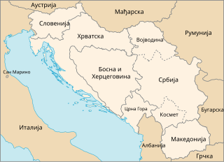
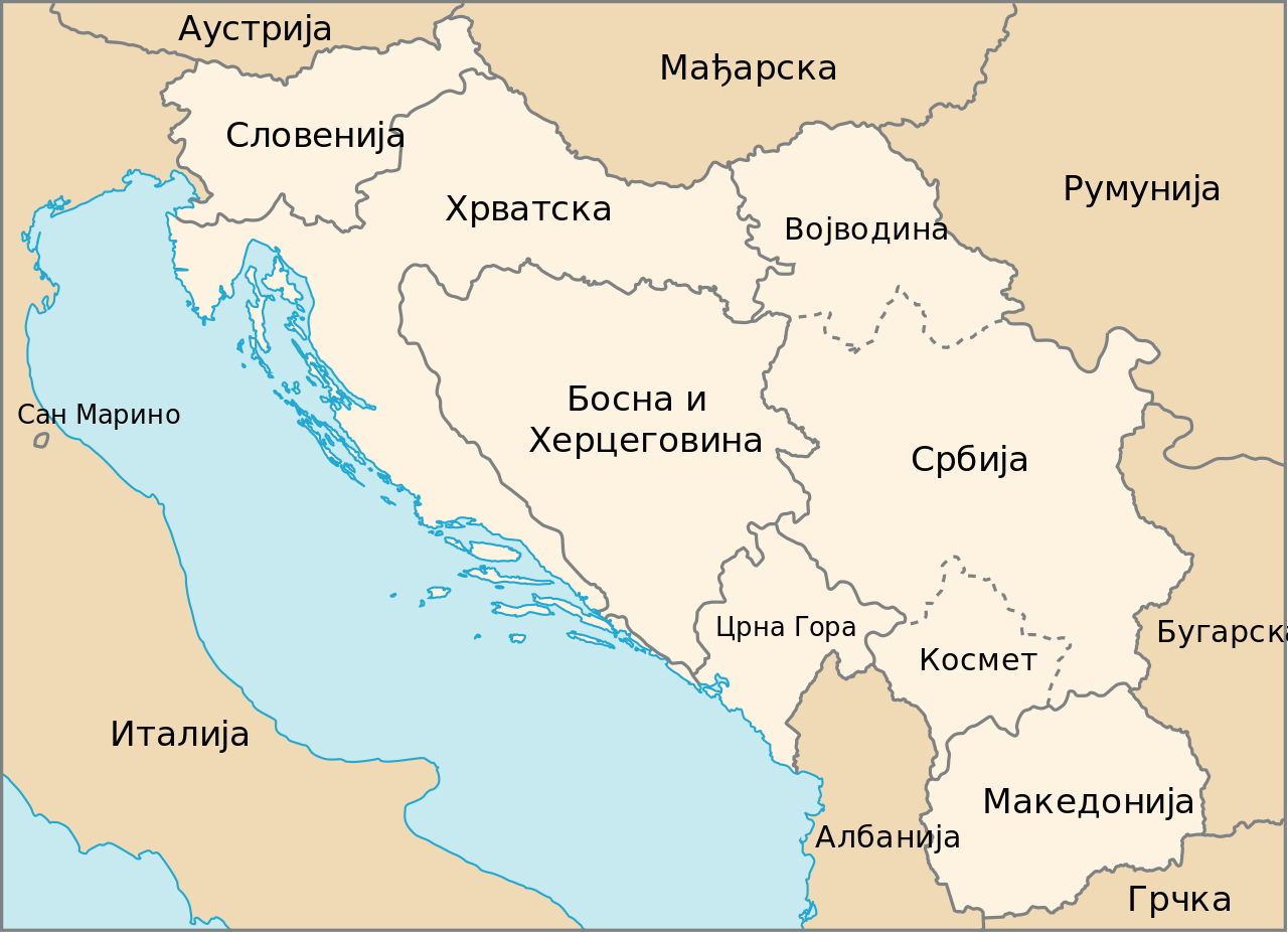
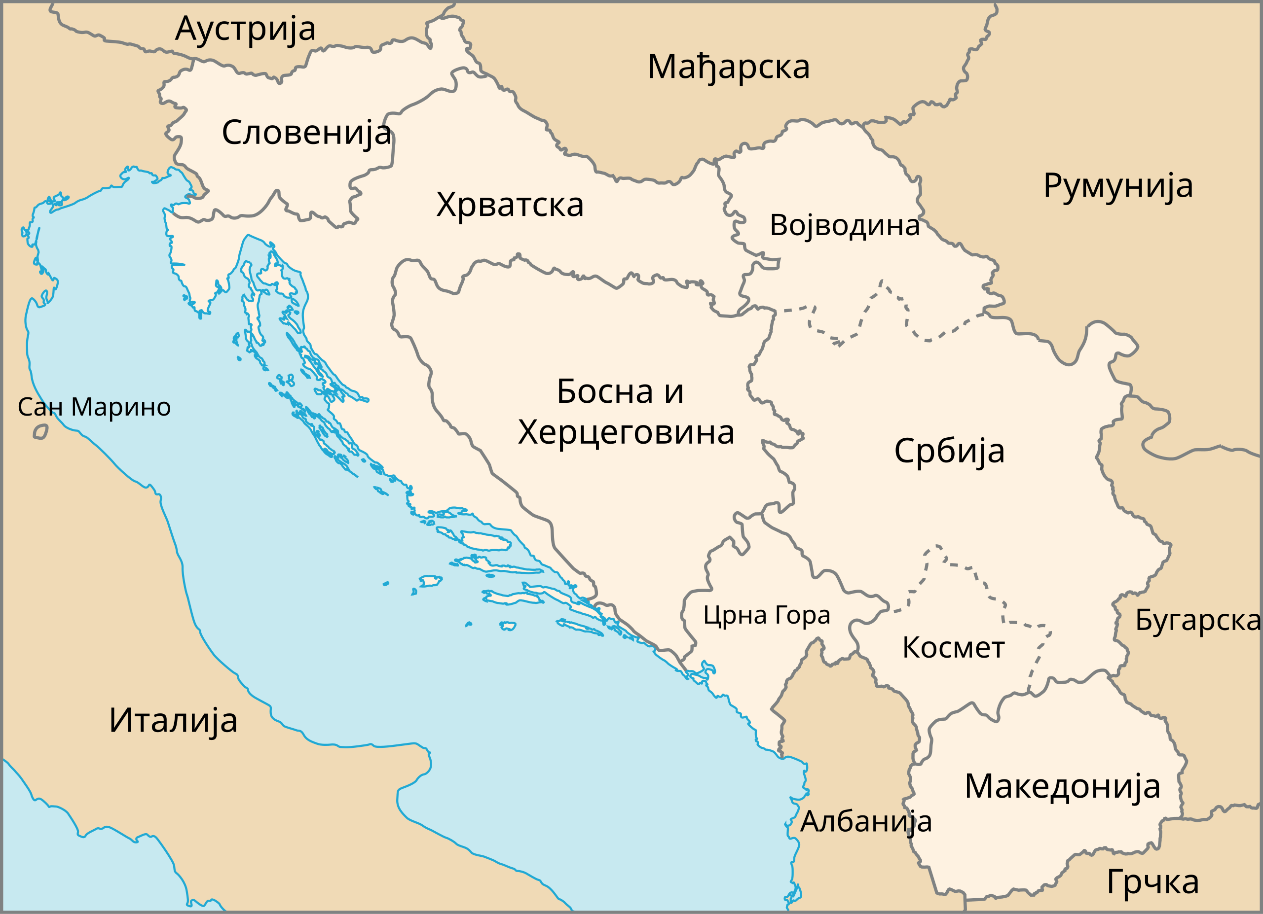
| Description | Map of The Former Yugoslavia in Serbia | |||
| Date | February, 2003 (created), Mart, 2008 (edited) | |||
| Source | http://www.un.org/Depts/Cartographic/map/profile/frmryugo.pdf | |||
| Author | Department of Public Information Cartographic Section, edited by Jovanvb | |||
| Permission (Reusing this file) |
|

File history
Click on a date/time to view the file as it appeared at that time.
| Date/Time | Thumbnail | Dimensions | User | Comment | |
|---|---|---|---|---|---|
| current | 14:42, 4 March 2008 | | 595 × 431 (316 KB) | Јованвб | {{Information| |Description=Map of The Former Yugoslavia in Serbia |Source=http://www.un.org/Depts/Cartographic/map/profile/frmryugo.pdf |Date=February, 2003 (created), Mart, 2008 (edited) |Author=Department of Public Information Cartographic Section, edi |
File usage
There are no pages that use this file.
Global file usage
The following other wikis use this file:
- Usage on ky.wikipedia.org
- Usage on sh.wikipedia.org
- Usage on sr.wikipedia.org