File:Waterfall Bahati Camp Uluguru Morogoro.jpg

Original file(7,559 × 1,693 pixels, file size: 9.52 MB, MIME type: image/jpeg)

This is a file from the Wikimedia Commons. The description on its description page there is copied below.

Description
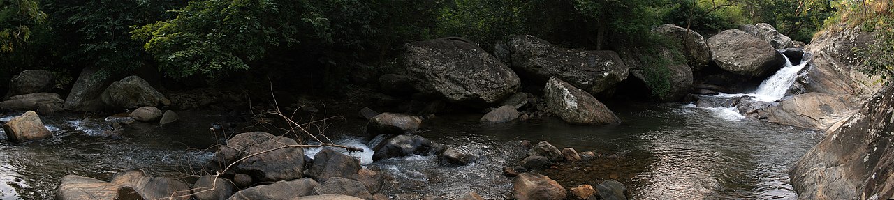
English: Waterfalls at Bahati Camp, the first of three camp areas in the Uluguru Mountains.
Date
Source Own work
Author Muhammad Mahdi Karim
Permission
(Reusing this file)


Summary:
In using this image or any subsequent derivatives of it, you are required to release the image under the same license. As such, any reproduction of this image, in any medium, must appear with a copy of, or full URL of the license.
Attribution of this image to the author (Muhammad Mahdi Karim) is required in a prominent location near to the image.
No other conditions may be added to, or removed from this license without the permission of the author and copyright holder.
I, the copyright holder of this work, hereby publish it under the following license:
GNU head Permission is granted to copy, distribute and/or modify this document under the terms of the GNU Free Documentation License, Version 1.2 or any later version published by the Free Software Foundation; with no Invariant Sections, no Front-Cover Texts, and no Back-Cover Texts. A copy of the license is included in the section entitled GNU Free Documentation License.

Taken by Muhammad Mahdi Karim
If you use my picture please let me know on my talk page. For any other concerns, such as need for a higher resolution version of the image, or a commercial license, contact me through my talk page or e-mail me . More images can be found in my gallery.
Camera location6° 48′ 23.5″ S, 37° 38′ 52.1″ E Kartographer map based on OpenStreetMap.View this and other nearby images on: OpenStreetMapinfo

This image has been assessed using the Quality image guidelines and is considered a Quality image.

العربية  جازايرية  беларуская  беларуская (тарашкевіца)  български  বাংলা  català  čeština  Cymraeg  Deutsch  Schweizer Hochdeutsch  Zazaki  Ελληνικά  English  Esperanto  español  eesti  euskara  فارسی  suomi  français  galego  עברית  हिन्दी  hrvatski  magyar  հայերեն  Bahasa Indonesia  italiano  日本語  Jawa  ქართული  한국어  kurdî  Lëtzebuergesch  lietuvių  македонски  മലയാളം  मराठी  Bahasa Melayu  Nederlands  Norfuk / Pitkern  polski  português  português do Brasil  rumantsch  română  русский  sicilianu  slovenčina  slovenščina  shqip  српски / srpski  svenska  தமிழ்  తెలుగు  ไทย  Tagalog  Türkçe  toki pona  українська  vèneto  Tiếng Việt  中文  中文(简体)  中文(繁體)  +/−

Captions

Add a one-line explanation of what this file represents

Items portrayed in this file

depicts

6°48'23.501"S, 37°38'52.102"E

image/jpeg

File history

Click on a date/time to view the file as it appeared at that time.

Date/TimeThumbnailDimensionsUserComment
current06:11, 30 January 2013Thumbnail for version as of 06:11, 30 January 20137,559 × 1,693 (9.52 MB)Slick-o-botBot: convert to a non-interlaced jpeg (see bug #17645)
20:12, 11 July 2008Thumbnail for version as of 20:12, 11 July 20087,559 × 1,693 (8.98 MB)Muhammad Mahdi Karim{{Information |Description={{en|Waterfalls at '''Bahati Camp''', the first of three camp areas in the mountain.}} |Source=self=made |Date=2008 |Author=Muhammad Mahdi Karim |Permission={{MMahdi}} |other_versions= }} {{ImageUpl

The following 2 pages use this file:

Global file usage

The following other wikis use this file:

Metadata