File:Slovakia-geographic map-en.svg

Size of this PNG preview of this SVG file: 800 × 420 pixels. Other resolutions: 320 × 168 pixels | 640 × 336 pixels | 1,024 × 538 pixels | 1,280 × 672 pixels | 2,560 × 1,344 pixels | 2,285 × 1,200 pixels.
Original file (SVG file, nominally 2,285 × 1,200 pixels, file size: 11.48 MB)
Summary
| Description |
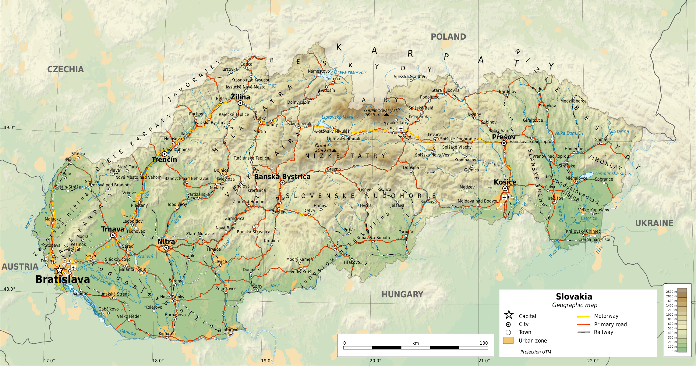
English: Geographic map of Slovakia. Geographic limits of the map:
|
| Date | |
| Source |
Own work
|
| Author | Ikonact |
| Permission (Reusing this file) |
Any use of this map is subject of the license(s) stated below with the condition that you credit (Wikimedia Commons user: Ikonact) as the author . A message with a reply address would also be greatly appreciated. |
| Other versions |
|


|
This SVG file contains embedded text that can be translated into your language, using any capable SVG editor, text editor or the SVG Translate tool. For more information see: About translating SVG files. |
Licensing
| This work contains information from OpenStreetMap, which is made available under the Open Database License (ODbL).
The ODbL does not require any particular license for maps produced from ODbL data. Prior to 1 August 2020, map tiles produced by the OpenStreetMap Foundation were licensed under the CC-BY-SA-2.0 license. Maps produced by other people may be subject to other licences. |
I, the copyright holder of this work, hereby publish it under the following license:
This file is licensed under the Creative Commons Attribution-Share Alike 4.0 International license.
- You are free:
- to share – to copy, distribute and transmit the work
- to remix – to adapt the work
- Under the following conditions:
- attribution – You must give appropriate credit, provide a link to the license, and indicate if changes were made. You may do so in any reasonable manner, but not in any way that suggests the licensor endorses you or your use.
- share alike – If you remix, transform, or build upon the material, you must distribute your contributions under the same or compatible license as the original.
File history
Click on a date/time to view the file as it appeared at that time.
| Date/Time | Thumbnail | Dimensions | User | Comment | |
|---|---|---|---|---|---|
| current | 21:55, 31 May 2021 | | 2,285 × 1,200 (11.48 MB) | Martin Tauchman | Geographical name of Czechia |
| 21:46, 28 November 2017 |  | 2,285 × 1,200 (11.48 MB) | Ikonact | small correction name font | |
| 21:20, 28 November 2017 |  | 2,285 × 1,200 (11.48 MB) | Ikonact | more names | |
| 22:50, 27 November 2017 |  | 2,285 × 1,200 (11.48 MB) | Ikonact | geographic names added | |
| 22:03, 24 November 2017 |  | 2,285 × 1,200 (11.46 MB) | Ikonact | =={{int:filedesc}}== {{Information |description={{en|1=Geographic map of Slovakia. Geographic limits of the map:}} *S: 47.6° N *N: 49.8° N *W: 16.6° W *E: 23.0° W Projection: UTM |date=2017-11-24 |source={{own}} *Sources of data:<b... |
File usage
There are no pages that use this file.
Global file usage
The following other wikis use this file:
- Usage on sk.wikipedia.org
- Usage on uk.wikipedia.org