File:Old Skeena Bridge.jpg

Size of this preview: 800 × 534 pixels. Other resolutions: 320 × 213 pixels | 640 × 427 pixels | 1,024 × 683 pixels.
Original file (1,024 × 683 pixels, file size: 248 KB, MIME type: image/jpeg)
Summary
| Camera location | | View this and other nearby images on: OpenStreetMap |
|---|
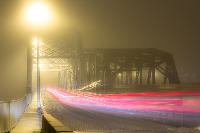
| Description |
English: The Old Skeena Bridge in Terrace, BC was built like forever ago! (50+ years or so?) It used to be the longest bridge ever built with these huge trees from Africa. This isn't exact or descriptive enough but it's actually totally true.
|
This photo is of a cultural heritage site in Canada, number 14604
|
|
| Date | |
| Source | Own work |
| Author | www.chasehamilton.ca |
www.chasehamilton.ca
Licensing
I, the copyright holder of this work, hereby publish it under the following license:
This file is licensed under the Creative Commons Attribution-Share Alike 3.0 Unported license.
- You are free:
- to share – to copy, distribute and transmit the work
- to remix – to adapt the work
- Under the following conditions:
- attribution – You must give appropriate credit, provide a link to the license, and indicate if changes were made. You may do so in any reasonable manner, but not in any way that suggests the licensor endorses you or your use.
- share alike – If you remix, transform, or build upon the material, you must distribute your contributions under the same or compatible license as the original.

|
This image was nominated as a finalist in Wiki Loves Monuments 2012, the world's largest photo contest! |

|
This image was uploaded as part of Wiki Loves Monuments 2012.
|
File history
Click on a date/time to view the file as it appeared at that time.
| Date/Time | Thumbnail | Dimensions | User | Comment | |
|---|---|---|---|---|---|
| current | 00:50, 9 September 2012 | | 1,024 × 683 (248 KB) | Chasehamilton2012 | User created page with UploadWizard |
File usage
The following page uses this file:
Global file usage
The following other wikis use this file:
- Usage on ca.wikimedia.org
- Usage on en.wikipedia.org
- Usage on fr.wikipedia.org
- Usage on zh.wikipedia.org