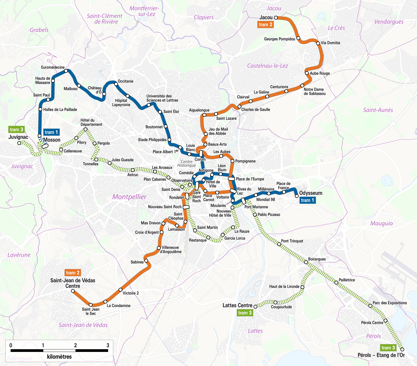
File:Montpellier - Tramway network map 2010.png
Size of this preview: 684 × 600 pixels. Other resolutions: 274 × 240 pixels | 547 × 480 pixels | 876 × 768 pixels | 1,168 × 1,024 pixels | 1,690 × 1,482 pixels.
Original file (1,690 × 1,482 pixels, file size: 1.51 MB, MIME type: image/png)

|
This transport map image could be re-created using vector graphics as an SVG file. This has several advantages; see Commons:Media for cleanup for more information. If an SVG form of this image is available, please upload it and afterwards replace this template with
{{vector version available|new image name}}.
It is recommended to name the SVG file “Montpellier - Tramway network map 2010.svg”—then the template Vector version available (or Vva) does not need the new image name parameter. |
| Description |
|
| Date | see file history |
| Source | Own work, using OpenStreetMap data for the background |
| Author | Maximilian Dörrbecker (Chumwa) |
| Permission (Reusing this file) |
All OpenStreetMap data and maps are Creative Commons "CC-BY-SA 2.0" licensed This file is licensed under the Creative Commons Attribution-Share Alike 2.0 Generic license.
|
| Other versions |
|


File history
Click on a date/time to view the file as it appeared at that time.
| Date/Time | Thumbnail | Dimensions | User | Comment | |
|---|---|---|---|---|---|
| current | 20:55, 9 January 2011 | | 1,690 × 1,482 (1.51 MB) | Chumwa | new station "Mondial 98" added |
| 05:52, 17 August 2010 |  | 3,521 × 3,087 (2.58 MB) | Chumwa | {{Information |Description= *{{ de }} Karte: Netzplan der Straßenbahn Montpellier 2010 *{{ en }} Map of the Montpellier streetcar network 2010 *{{ fr }} Plan de réseau des tramways de Montpellier 2010 |Author=Maximilian Dörrbecker ( |
File usage
The following page uses this file:
Global file usage
The following other wikis use this file:
- Usage on eu.wikipedia.org
- Usage on fr.wikipedia.org
- Usage on www.wikidata.org