File:Metro Manila location map.svg

Size of this PNG preview of this SVG file: 333 × 600 pixels. Other resolutions: 133 × 240 pixels | 266 × 480 pixels | 426 × 768 pixels | 568 × 1,024 pixels | 1,137 × 2,048 pixels | 512 × 922 pixels.
Original file (SVG file, nominally 512 × 922 pixels, file size: 224 KB)
Summary
| Description | |||
| Date | |||
| Source |
|
||
| Author | Philtro | ||
| Other versions |
|

Licensing
Philtro, the copyright holder of this work, hereby publishes it under the following licenses:
This file is licensed under the Creative Commons Attribution-Share Alike 3.0 Unported license.
Attribution: Philtro
- You are free:
- to share – to copy, distribute and transmit the work
- to remix – to adapt the work
- Under the following conditions:
- attribution – You must give appropriate credit, provide a link to the license, and indicate if changes were made. You may do so in any reasonable manner, but not in any way that suggests the licensor endorses you or your use.
- share alike – If you remix, transform, or build upon the material, you must distribute your contributions under the same or compatible license as the original.

|
Permission is granted to copy, distribute and/or modify this document under the terms of the GNU Free Documentation License, Version 1.2 or any later version published by the Free Software Foundation; with no Invariant Sections, no Front-Cover Texts, and no Back-Cover Texts. A copy of the license is included in the section entitled GNU Free Documentation License. |
You may select the license of your choice.
Original upload log
Transferred from en.wikipedia to Commons using For the Common Good.
The original description page was here. All following user names refer to en.wikipedia.
| Date/Time | Dimensions | User | Comment |
|---|---|---|---|
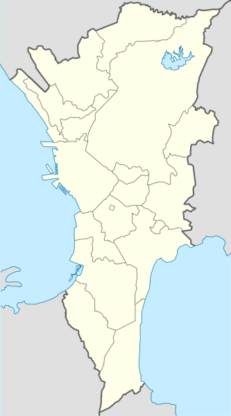
| 13:58, 8 May 2011 | 700 × 1,260 (227,098 bytes) | w:en:Philtro (talk | contribs) | ({{Information |Description= Location map of [[Metro Manila]], [[Philippines]] |Source= * Map derived from [[:File:BlankMap-MetroManila.png]] * Colors and stroke widths based from [[:File:Italy location map.svg]] |Author= [[User:Philtro|Philtro]] |Permissi) |
File history
Click on a date/time to view the file as it appeared at that time.
| Date/Time | Thumbnail | Dimensions | User | Comment | |
|---|---|---|---|---|---|
| current | 07:11, 11 November 2023 | | 512 × 922 (224 KB) | Hariboneagle927 | update |
| 07:10, 11 November 2023 |  | 512 × 922 (224 KB) | Hariboneagle927 | Taguig Oct 2023 update | |
| 12:19, 1 November 2023 |  | 512 × 922 (233 KB) | Hariboneagle927 | dashed line for Embo. To be absorbed by Taguig pending writ of execution | |
| 13:32, 30 September 2021 |  | 512 × 922 (244 KB) | Hariboneagle927 | +Las Piñas-Parañaque Critical Habitat, +Baseco, and La Mesa Watershed | |
| 06:26, 4 July 2021 |  | 512 × 922 (199 KB) | Hariboneagle927 | readjust MSC exclave | |
| 09:27, 23 January 2018 |  | 512 × 922 (199 KB) | Hariboneagle927 | size | |
| 09:25, 23 January 2018 |  | 440 × 792 (195 KB) | Hariboneagle927 | Manila South Cemetery exclave (Manila) in Makati | |
| 07:52, 18 December 2014 |  | 512 × 922 (135 KB) | Photo07 | Minor changes | |
| 15:47, 31 January 2012 |  | 700 × 1,260 (222 KB) | Bulwersator | Transferred from en.wikipedia: see original upload log above |
File usage
The following page uses this file:
Global file usage
The following other wikis use this file:
- Usage on ar.wikipedia.org
- Usage on bcl.wikipedia.org
- Usage on ceb.wikipedia.org
- Usage on da.wikipedia.org
- Usage on en.wikipedia.org
- Metro Manila
- University of the Philippines Diliman
- Pasig River
- University Athletic Association of the Philippines
- Malacañang Palace
- Congress of the Philippines
- Girl Scouts of the Philippines
- Rizal Day bombings
- Ortigas Center
- Araneta City
- Fort Santiago
- Camp Aguinaldo
- National University (Philippines)
- Universities and Colleges Athletic Association
- Bonifacio Global City
- Asia Pacific College
- Philippine Heart Center
- Rosario Sports Complex
- Premier Volleyball League
- Divisoria
- Saint Francis of Assisi College
- Don Bosco Technical College
- List of rail transit stations in the Greater Manila Area
- De La Salle Araneta University
- College basketball in the Philippines
- St. Scholastica's College, Manila
- Oakwood mutiny
- Ospital ng Maynila Medical Center
- List of presidents of the Philippines by province
- National Defense College of the Philippines
- Baclaran
- Adventist Medical Center Manila
- Polytechnic University of the Philippines Taguig
- St. Paul University Manila
- Lung Center of the Philippines
- Saint Stephen's Parish Church (Manila)
- Dr. Jose Fabella Memorial Hospital
- Assumption College San Lorenzo
- Polytechnic University of the Philippines Quezon City
View more global usage of this file.