File:Map of Russia - Urals Federal District.svg

Size of this PNG preview of this SVG file: 800 × 462 pixels. Other resolutions: 320 × 185 pixels | 640 × 369 pixels | 1,024 × 591 pixels | 1,280 × 738 pixels | 2,560 × 1,477 pixels | 1,092 × 630 pixels.
Original file (SVG file, nominally 1,092 × 630 pixels, file size: 118 KB)

|
The boundaries on this map show the de facto situation. This is just one of several different views on the subject (see COM:NPOV). |
| Description |
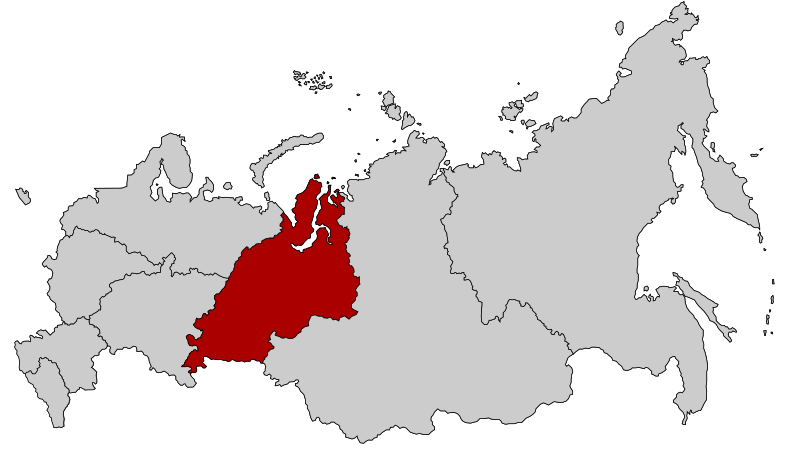
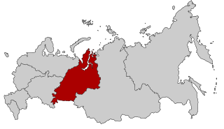
English: Map Russia highlighting the Urals Federal districts.
Español: Ubicación del Distrito Federal de los Urales en la Federación Rusa
Русский: Уральский федеральный округ |
| Date | |
| Source | Based on Map of Russian subjects, 2008-03-01.svg by Lokal_Profil |
| Author | Lokal_Profil |
| Permission (Reusing this file) |
This file is licensed under the Creative Commons Attribution-Share Alike 2.5 Generic license.
|
File history
Click on a date/time to view the file as it appeared at that time.
| Date/Time | Thumbnail | Dimensions | User | Comment | |
|---|---|---|---|---|---|
| current | 20:41, 26 February 2022 | | 1,092 × 630 (118 KB) | Valar999 | NPOV Issue |
| 14:20, 10 March 2015 |  | 1,092 × 630 (95 KB) | Knyaz-1988 | Reverted to version as of 22:07, 3 November 2014 | |
| 01:32, 4 November 2014 |  | 1,092 × 630 (118 KB) | Fry1989 | NPOV issue. | |
| 22:07, 3 November 2014 |  | 1,092 × 630 (95 KB) | Knyaz-1988 | New version | |
| 22:28, 21 January 2010 |  | 1,092 × 630 (118 KB) | Denhud | On 2010-01-19 Southern Federal District split in two, with its former southern territories forming new North Caucasian Federal District. | |
| 23:37, 3 March 2008 |  | 1,092 × 630 (112 KB) | Lokal Profil | {{Information |Description=Map Russia highlighting the Urals Federal districts. |Source=Based on Map of Russian subjects, 2008-03-01.svg by [[:user:Lokal_Profil|Lokal_P |
File usage
The following page uses this file:
Global file usage
The following other wikis use this file:
- Usage on ar.wikipedia.org
- Usage on az.wikipedia.org
- Usage on ba.wikipedia.org
- Usage on be-tarask.wikipedia.org
- Usage on be.wikipedia.org
- Usage on bg.wikipedia.org
- Usage on bs.wikipedia.org
- Usage on bxr.wikipedia.org
- Usage on ca.wikipedia.org
- Usage on cv.wikipedia.org
- Usage on da.wikipedia.org
- Usage on el.wikipedia.org
- Usage on en.wikipedia.org
- Usage on eo.wikipedia.org
- Usage on es.wikipedia.org
- Usage on eu.wikipedia.org
- Usage on fa.wikipedia.org
- Usage on frr.wikipedia.org
- Usage on fr.wikipedia.org
- Usage on hr.wikipedia.org
- Usage on hu.wikipedia.org
- Usage on hy.wikipedia.org
- Usage on id.wikipedia.org
- Usage on ja.wikipedia.org
- Usage on ka.wikipedia.org
- Usage on koi.wikipedia.org
- Usage on ko.wikipedia.org
- Usage on mk.wikipedia.org
- Usage on mn.wikipedia.org
- Usage on mr.wikipedia.org
- Usage on ms.wikipedia.org
- Usage on nl.wikipedia.org
View more global usage of this file.