File:Indonesia Papua 2022 location map.svg

Size of this PNG preview of this SVG file: 800 × 511 pixels. Other resolutions: 320 × 204 pixels | 640 × 409 pixels | 1,024 × 654 pixels | 1,280 × 817 pixels | 2,560 × 1,634 pixels | 2,832 × 1,808 pixels.
Original file (SVG file, nominally 2,832 × 1,808 pixels, file size: 144 KB)
Summary
| Description |
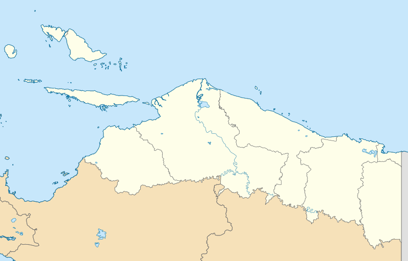
English: Location map of Papua, Indonesia
WGS84, UTM
|
| Date | |
| Source | Own work |
| Author | Envapid |
Licensing
I, the copyright holder of this work, hereby publish it under the following license:
This file is licensed under the Creative Commons Attribution-Share Alike 4.0 International license.
- You are free:
- to share – to copy, distribute and transmit the work
- to remix – to adapt the work
- Under the following conditions:
- attribution – You must give appropriate credit, provide a link to the license, and indicate if changes were made. You may do so in any reasonable manner, but not in any way that suggests the licensor endorses you or your use.
- share alike – If you remix, transform, or build upon the material, you must distribute your contributions under the same or compatible license as the original.
File history
Click on a date/time to view the file as it appeared at that time.
| Date/Time | Thumbnail | Dimensions | User | Comment | |
|---|---|---|---|---|---|
| current | 15:47, 9 January 2024 | | 2,832 × 1,808 (144 KB) | Envapid | fix2 |
| 13:51, 9 January 2024 |  | 2,832 × 1,808 (144 KB) | Envapid | Uploaded own work with UploadWizard |
File usage
The following page uses this file:
Global file usage
The following other wikis use this file:
- Usage on ban.wikipedia.org
- Usage on en.wikipedia.org
- Biak
- Yapen
- Dortheys Hiyo Eluay International Airport
- Supiori Island
- Module:Location map/data/Indonesia Papua/doc
- Numfor
- Battle of Noemfoor
- Kornasoren Airport
- Wakde Airfield
- Owi Airfield
- Battle of Wakde
- Tariku River
- Van Daalen River
- Taritatu River
- 2010 Papua earthquake
- 1996 Biak earthquake
- Sobger River
- Waruta River
- Songgato River
- Arso Airport
- Dabra Airport
- Lake Sentani
- Module:Location map/data/Indonesia Papua
- User:Ty654/List of earthquakes exceeding magnitude 8+
- User:Ty654/List of earthquakes from 1900-1949 exceeding magnitude 7+
- User:Ty654/List of earthquakes from 1950-1999 exceeding magnitude 7+
- User:Ty654/List of earthquakes from 2000-present exceeding magnitude 7+
- User:Ty654/List of earthquakes from 1910-1919 exceeding magnitude 6+
- User:Ty654/List of earthquakes from 1920-1929 exceeding magnitude 6+
- User:Ty654/List of earthquakes from 1930-1939 exceeding magnitude 6+
- User:Ty654/List of earthquakes from 1940-1949 exceeding magnitude 6+
- User:Ty654/List of earthquakes from 1950-1954 exceeding magnitude 6+
- User:Ty654/List of earthquakes from 1955-1959 exceeding magnitude 6+
- User:Ty654/List of earthquakes from 1960-1964 exceeding magnitude 6+
- User:Ty654/List of earthquakes from 1965-1969 exceeding magnitude 6+
- User:Ty654/List of earthquakes from 1970-1974 exceeding magnitude 6+
- User:Ty654/List of earthquakes from 1975-1979 exceeding magnitude 6+
- User:Ty654/List of earthquakes from 1980-1984 exceeding magnitude 6+
- User:Ty654/List of earthquakes from 1985-1989 exceeding magnitude 6+
- User:Ty654/List of earthquakes from 1990-1994 exceeding magnitude 6+
- User:Ty654/List of earthquakes from 1995-1999 exceeding magnitude 6+
- User:Ty654/List of earthquakes from 2000-2004 exceeding magnitude 6+
- User:Ty654/List of earthquakes from 2005-2009 exceeding magnitude 6+
- User:Ty654/List of earthquakes from 2010-2014 exceeding magnitude 6+
- User:Ty654/List of earthquakes from 2015-2019 exceeding magnitude 6+
View more global usage of this file.