File:Boerenkrokus (Crocus tommasinianus) 28-02-2023 (d.j.b.).jpg

Original file (2,717 × 2,717 pixels, file size: 5.18 MB, MIME type: image/jpeg)
_28-02-2023_(d.j.b.).jpg)
Summary
| Description |
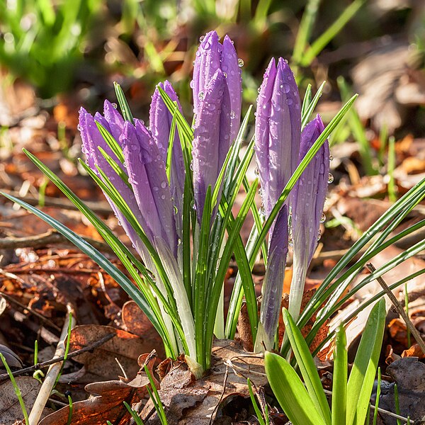
Nederlands: Met regendruppels bedekte Crocus tommasinianus Focus stapel van 15 foto’s.
English: Covered with raindrops Crocus tommasinianus Focus stack of 15 photos. |
| Date | |
| Source | Own work |
| Author | Dominicus Johannes Bergsma |
| Camera location | | View this and other nearby images on: OpenStreetMap |
|---|
_28-02-2023_(d.j.b.).jpg¶ms=052.969900_N_0005.785300_E_globe:Earth_type:camera__&language=en)
|
_28-02-2023_(d.j.b.).jpg)

|
NOTE: This image is a focus stacked image consisting of multiple images that were merged using software. As a result, this image underwent digital manipulation which may have included blending, blurring, cloning, and colour and perspective adjustments. As a result of these adjustments, the image content may be slightly different than reality at the points where the images were combined. This manipulation is often required due to lens, perspective, and parallax distortions.
|
Locatie: Natuurterrein De Famberhorst is een belangrijke schakel in de ecologische verbinding (groene as) tussen het Friese merengebied, natuurgebied De Twigen, historische windsingel Omkromte, het natuurterrein De Famberhorst en park Heremastate in Joure.
English: Location: The Famberhorst nature reserve is an important link in the ecological connection (green axis) between the Frisian lakes, the historic windbreak Omkromte, the nature reserve and park The Famberhorst Heremastate in Joure.
Licensing
- You are free:
- to share – to copy, distribute and transmit the work
- to remix – to adapt the work
- Under the following conditions:
- attribution – You must give appropriate credit, provide a link to the license, and indicate if changes were made. You may do so in any reasonable manner, but not in any way that suggests the licensor endorses you or your use.
- share alike – If you remix, transform, or build upon the material, you must distribute your contributions under the same or compatible license as the original.
This image has been assessed using the Quality image guidelines and is considered a Quality image.
|
File history
Click on a date/time to view the file as it appeared at that time.
| Date/Time | Thumbnail | Dimensions | User | Comment | |
|---|---|---|---|---|---|
| current | 05:44, 2 March 2023 | | 2,717 × 2,717 (5.18 MB) | Famberhorst | Uploaded own work with UploadWizard |
File usage
The following 31 pages use this file:
- Wikimedians for Sustainable Development/Newsletter/2023-03
- User talk:ANKAN
- User talk:Afifa Afrin
- User talk:Ai24/Archive 8
- User talk:Akwugo
- User talk:Argeste
- User talk:Atibrarian
- User talk:Bile rene
- User talk:Bluerasberry
- User talk:Camelia.boban/Archive 4
- User talk:DaSupremo
- User talk:Daphpb
- User talk:Dbsnp
- User talk:DeLilGwashoper
- User talk:Dick Bos
- User talk:Discott
- User talk:Eric Luth (WMSE)
- User talk:Felino Volador
- User talk:James Rhoda
- User talk:Kaizenify
- User talk:Killim
- User talk:Leezie eia
- User talk:Major Lyte
- User talk:MusikAnimal/Archive 1
- User talk:NanaYawBotar
- User talk:Rolandog
- User talk:Semmy1960
- User talk:So9q
- User talk:Tris T7
- User talk:Txtdgtl
- User talk:Zblace
Global file usage
The following other wikis use this file:
- Usage on bn.wikipedia.org
- Usage on ca.wikipedia.org
- Usage on cs.wikipedia.org
- Usage on de.wikipedia.org
- Usage on en.wikipedia.org
- User talk:Guettarda
- User talk:Anon423
- User talk:MassiveEartha
- User talk:Hadi
- User talk:Harvinder Chandigarh
- User talk:Anass Sedrati
- User talk:SIVAHAKASH
- User talk:Timmylegend
- User talk:Godstime Elijah
- User talk:James Moore200
- User talk:Ptinphusmia
- User talk:Cnyirahabihirwe123
- User talk:Zend2020
- User talk:RukayatAjeigbe
- User talk:Omorodion1/Archive 4
- User talk:Yohannvt/Archive 9
- User talk:Gobonobo/Archive 60
- User talk:Em-mustapha/Archive 12
- User talk:OhKayeSierra/Archive 18
- User talk:Peaceray/archive/2023
- User talk:Daylen/Archive 2023
- User talk:Wil540 art/Archive 6
- User talk:Ambrosia10/Archive 6
- Usage on es.wikipedia.org
- Usage on fr.wikipedia.org
- Usage on ha.wikipedia.org
- Usage on hi.wikipedia.org
- Usage on ig.wikipedia.org
- Usage on it.wikipedia.org
- Usage on ml.wikipedia.org
- Usage on nl.wikipedia.org
- Usage on outreach.wikimedia.org
View more global usage of this file.
_28-02-2023_(d.j.b.).jpg)
_28-02-2023_(d.j.b.).jpg)