File:1850 Mitchell Map of Austria, Hungary and Transylvania - Geographicus - Austria-mitchell-1850.jpg

Size of this preview: 755 × 600 pixels. Other resolutions: 302 × 240 pixels | 604 × 480 pixels | 967 × 768 pixels | 1,280 × 1,017 pixels | 2,560 × 2,033 pixels | 3,000 × 2,383 pixels.
Original file (3,000 × 2,383 pixels, file size: 2.31 MB, MIME type: image/jpeg)
| Samuel Augustus Mitchell: Austrian Empire.
( |
||||||||||||||||||||
|---|---|---|---|---|---|---|---|---|---|---|---|---|---|---|---|---|---|---|---|---|
| Artist |
|
|||||||||||||||||||
| Title |
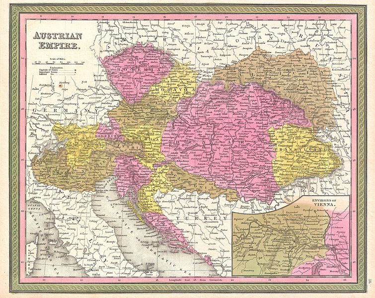
Austrian Empire. |
|||||||||||||||||||
| Description |
English: An extremely attractive example of S. A. Mitchell Sr.’s 1850 map of the Austrian Empire. Includes much of today's Austria, Hungary, Romania, Albania, Serbia and Croatia. Depicts the entire country color coded according to individual states. Lower right quadrant features an inset map of the Environs of Vienna. Surrounded by the green border common to Mitchell maps from the 1850s. Prepared by S. A. Mitchell for issued as plate no. 56 in the 1850 edition of his New Universal Atlas . |
|||||||||||||||||||
| Date | 1850 (undated) | |||||||||||||||||||
| Dimensions | height: 12 in (30.4 cm); width: 15 in (38.1 cm) | |||||||||||||||||||
| Accession number |
Geographicus link: Austria-mitchell-1850 |
|||||||||||||||||||
| Source/Photographer |
Mitchell Sr., S. A.,A New Universal Atlas Containing Maps of the various Empires, Kingdoms, States and Republics Of The World. (1850 issue)
|
|||||||||||||||||||
| Permission (Reusing this file) |
|
|||||||||||||||||||
File history
Click on a date/time to view the file as it appeared at that time.
| Date/Time | Thumbnail | Dimensions | User | Comment | |
|---|---|---|---|---|---|
| current | 01:09, 23 March 2011 | | 3,000 × 2,383 (2.31 MB) | BotMultichillT | {{subst:User:Multichill/Geographicus |link=http://www.geographicus.com/P/AntiqueMap/Austria-mitchell-1850 |product_name=1850 Mitchell Map of Austria, Hungary and Transylvania |map_title=Austrian Empire. |description=An extremely attractive example of S. A |
File usage
The following page uses this file:
Global file usage
The following other wikis use this file:
- Usage on en.wikipedia.org
- Usage on es.wikipedia.org
- Usage on hr.wikipedia.org
- Usage on sh.wikipedia.org
- Usage on uk.wikipedia.org