File:Wikimedia DC map.svg

Size of this PNG preview of this SVG file: 800 × 495 pixels. Other resolutions: 320 × 198 pixels | 640 × 396 pixels | 1,024 × 633 pixels | 1,280 × 791 pixels | 2,560 × 1,583 pixels | 959 × 593 pixels.
Original file (SVG file, nominally 959 × 593 pixels, file size: 90 KB)
Summary
| Description |
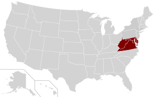
English: A map of the United States, featuring the area served by Wikimedia District of Columbia in maroon.
Español: Un mapa de los Estados Unidos, con la área de la sección Wikimedia Distrito de Columbia en granate. |
| Date | |
| Source | Derived from File:Blank US Map.svg |
| Author | James Hare |
| Permission (Reusing this file) |
CC-BY-SA 3.0 and GFDL |
Licensing
I, the copyright holder of this work, hereby publish it under the following licenses:
This file is licensed under the Creative Commons Attribution-Share Alike 3.0 Unported license.
- You are free:
- to share – to copy, distribute and transmit the work
- to remix – to adapt the work
- Under the following conditions:
- attribution – You must give appropriate credit, provide a link to the license, and indicate if changes were made. You may do so in any reasonable manner, but not in any way that suggests the licensor endorses you or your use.
- share alike – If you remix, transform, or build upon the material, you must distribute your contributions under the same or compatible license as the original.

|
Permission is granted to copy, distribute and/or modify this document under the terms of the GNU Free Documentation License, Version 1.2 or any later version published by the Free Software Foundation; with no Invariant Sections, no Front-Cover Texts, and no Back-Cover Texts. A copy of the license is included in the section entitled GNU Free Documentation License. |
You may select the license of your choice.
File history
Click on a date/time to view the file as it appeared at that time.
| Date/Time | Thumbnail | Dimensions | User | Comment | |
|---|---|---|---|---|---|
| current | 07:43, 13 September 2011 | | 959 × 593 (90 KB) | Harej | {{Information |Description ={{en|1=A map of the United States, featuring the area served by Wikimedia District of Columbia in maroon.}} |Source =Derived from File:Blank US Map.svg |Author =James Hare |Date |
File usage
The following 12 pages use this file:
- Wikimedia District of Columbia
- Wikimedia District of Columbia/ar
- Wikimedia District of Columbia/de
- Wikimedia District of Columbia/en
- Wikimedia District of Columbia/eo
- Wikimedia District of Columbia/es
- Wikimedia District of Columbia/fj
- Wikimedia District of Columbia/ja
- Wikimedia District of Columbia/ko
- Wikimedia District of Columbia/nl
- Wikimedia District of Columbia/th
- Wikimedia District of Columbia/zh
Global file usage
The following other wikis use this file:
- Usage on en.wikipedia.org